Before the Star Chart: How People Made Maps of the Heavens
Before printed star charts, Babylonian records and Greek star catalogues gave the heavens different kinds of order. See how early sky maps took shape.
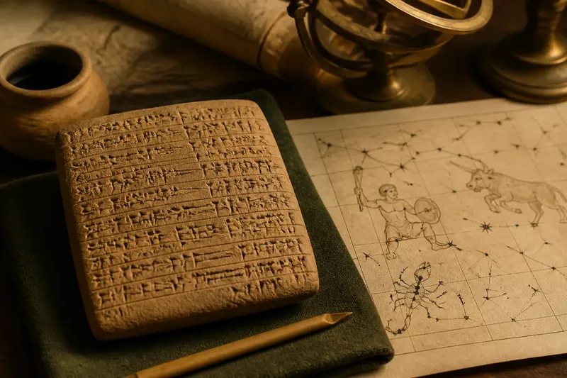
The oldest surviving Babylonian star catalogue is not a picture of the whole sky: it is a written list of celestial names and groupings. That distinction matters when tracing how people made maps of the heavens. A modern page full of dots and connecting lines is only one kind of map, and treating it as the starting point hides the very different records that came before it.
What did an early map of the heavens look like?
Early sky maps took several forms: lists of stars, records of constellations, diagrams on objects and descriptions that linked celestial patterns to a calendar or ritual. They did not all aim to show every star in its position. Some organised names and associations; others pictured a selected region or helped preserve a particular sequence of observations.
One named example is the Babylonian compendium known as MUL.APIN, preserved on cuneiform tablets. It arranges material about stars and constellations alongside information about the calendar and celestial phenomena. It is a structured guide to the sky, but not a modern atlas: its written organisation reflects the concerns and conventions of its own tradition.
That is a useful distinction for reading any historical chart. Ask what the object records, which celestial features it includes and what task its arrangement appears to serve. A list, a diagram and a navigational aid may all organise the heavens without using the same visual method.
How did Babylonian star records organise the sky?
Babylonian astronomers recorded stars and constellations in a named system, and MUL.APIN is a prominent surviving example of that tradition. Its material is arranged in sections rather than as a single, comprehensive star picture. The record connects celestial knowledge with timing and observation, so its structure tells us as much about how the information was used as about what was visible.
Babylonian records also included systematic observations of celestial events. These should not be collapsed into one category: a list of stars, a record of an event and a drawing are different kinds of evidence. When discussing early sky maps, be precise about which sort of record survives rather than claiming that every culture used a drawn chart like a modern one.
What changed in Greek star catalogues?
Greek writers developed another influential way to describe the sky. In the second century BCE, Hipparchus compiled a star catalogue, now lost, and in the second century CE Ptolemy included a catalogue in the Almagest. Ptolemy’s work gives positions for stars and groups them within constellations, making it a more explicitly positional record than a list organised only by names or associations.
These catalogues were not simply pictures. Coordinates and descriptions made it possible to identify stars within a systematic scheme, while constellation figures supplied a cultural framework for grouping them. The scheme reflects the astronomical methods and inherited knowledge available to its authors; it is not a neutral photograph of the sky.
Surviving works also need careful handling. Hipparchus’s catalogue is known through later accounts and comparisons, while Ptolemy’s catalogue survives as part of a larger astronomical text. Distinguishing a lost source from a surviving one keeps the history clear and avoids suggesting that every early catalogue can be inspected in its original form.
Why did different traditions draw different constellations?
Constellation figures are cultural interpretations of stars, not outlines fixed among them. Greek constellation names and figures became influential through later European sky atlases, but other peoples developed their own ways to divide and name the sky. The same visible stars could therefore belong to different figures or groupings in different traditions.
This variation does not mean that one tradition simply copied another in every case. Historical exchange did shape some systems, but claims about a particular borrowing need evidence tied to that example. It is safer to distinguish what a record actually shows from a broader story about how a constellation name travelled.
For a reader comparing old charts, the practical question is not which figure looks most convincing. It is which tradition made the chart, what its labels mean, and whether it was intended to record positions, preserve a story or organise observations.
How can you tell what an old sky map was for?
Begin with the object itself rather than assuming it was made for ordinary stargazing. A tablet covered in names, a catalogue with positions and a decorated celestial globe each preserve different information. Their materials, labels, layout and accompanying text offer clues to their intended use.
- If the record mainly gives names in a sequence, treat it as a catalogue or mnemonic arrangement; if it also supplies plotted positions, examine it as a positional chart.
- If a diagram highlights a limited region, check its labels and surrounding text; if no broader coverage is indicated, do not call it a complete map of the sky.
- If the object shows figures or creatures among the stars, identify the tradition named by its source; if that context is missing, describe the imagery without assigning it to a culture.
- If a text links stars with dates or recurring events, read it as a record with calendrical or observational purpose; if that link is absent, avoid claiming the chart served as a calendar.
- If the source is a later copy or translation, distinguish the surviving object from the earlier work it transmits; if the original is lost, say so rather than presenting the copy as the original.
- If a modern reconstruction adds connecting lines or labels, separate those additions from marks visible on the historical object; if the distinction is unclear, consult the object description before interpreting the pattern.
Say you are examining an invented museum display containing a clay tablet with a list of star names and a separate modern diagram beside it. First, you note that the tablet has no plotted dots or connecting lines; then you read its accompanying label, which identifies the text as a Babylonian star catalogue. You classify the tablet as a written record of celestial names, not as a drawn atlas, and treat the neighbouring diagram as a modern aid unless the display identifies it as a faithful reconstruction.
What do readers ask about the first star maps?
Was MUL.APIN a star chart?
It is a Babylonian cuneiform compendium that organises information about stars, constellations and celestial matters, but it is not a modern-style chart showing the whole sky as plotted points. Calling it a star catalogue or astronomical compendium is more precise than describing it as a complete atlas.
Did Hipparchus leave a surviving star catalogue?
His catalogue is lost, though later ancient sources refer to it and it is discussed in relation to Ptolemy’s work. Ptolemy’s Almagest, by contrast, survives as an astronomical text containing a star catalogue.
Did all ancient cultures use the same constellations?
No. Different traditions named and grouped stars in different ways, and some systems also changed through cultural contact. A chart’s figures should be read in the context of the people and period that produced it.
Were early sky maps used for navigation?
Some knowledge of the sky could assist orientation, but not every star record was made as a navigation tool. Identify the purpose supported by the particular object or text instead of assigning one use to every early map.
Which details are not worth the effort?
It is not useful to judge a historical constellation by whether its stars neatly resemble the creature or object in its picture. The figure records a cultural way of organising stars; the historical question is how that tradition named and grouped them.
Nor should every list, diagram or decorated object be forced into the category of a star atlas. The phrase “map of the heavens” can cover different forms of organisation, but naming the form accurately makes the history easier to understand.
When you encounter an early sky map, start by identifying what survives: names, positions, figures or records of events. That simple distinction helps you see how people made the heavens legible without mistaking a written catalogue for a picture of the night sky.